Many areas of coast are dynamic, literally never looking the same twice; a deep understanding of how and why these changes happen is something that humans have been grappling with for generations.

We live in an age where available technology is enabling this level of understanding. Earth observation and remote-sensing techniques produce vast volumes of data, offering tremendous value to a broad range of users. However, storing, loading and processing these large datasets is beyond the current capabilities of many users’ equipment and systems.
Our Synoptic 4D service uses radar to collect coastal data 24 hours a day, 7 days a week. Until now, we have been processing all the data on high performance workstations, analysing the results and digesting them into reports that answer specific questions for the user. This was a great place to start, but isn’t a solution that will scale well to meet our growing UK demand, let alone overseas. We recognised the need for a better way of delivering this coastal information to our customers that is more accessible to them and presents the data in format that allows them to explore regions of interest.
Most GIS (Geographic Information System) tools are not well suited to navigation in time as well as 3D space, so we started looking for a partner to develop a web-based platform that included this temporal aspect.
Folks at Hexagon were interested in applying their M.App Enterprise platform to help us solve some of the problems of coastal monitoring and management, particularly access to continually updated intertidal topography, bathymetry and hydrodynamic data.
Hexagon Geospatial are global leaders in geospatial software, with over 60 years of experience. In M.App Enterprise, Hexagon has brought together this experience to give a single platform capable of analysing, managing, and delivering geospatial (mapping, imagery) data. New technologies like artificial intelligence (AI), cloud computing, and spatial model processing are within M.App Enterprise and it is already in use with customers worldwide.
After a year of getting to know one another we partnered with Hexagon Geospatial just into 2020.
Then, like many, we were forced to deal with the challenges of working from home, redesigning safe working practices, supply chains shutting down, caring for those more seriously affected by the pandemic and countless uncertainties of lockdown #1.
Before long, summer was upon us and our intention to build a tool for our users to explore their data themselves was going nowhere. Our users and future customers were also dealing with a plethora of unimagined scenarios at work and home and many projects slowed to an apparent halt.
Then… a glimpse of the solution… word on the street of an innovation grant for Liverpool City Region companies. We had to wait for the announcement to appear on the www then go! Summer 2020 was not the summer we had been planning (who’s was) but restrictions were easing and we had a backlog of work to deliver for some customers who had thankfully been very understanding of the circumstances. Instead of sunbathing, learning another language or musical instrument, we bid for the Liverpool City Region Combined Authority – Future Innovation Fund. We thought it would go unnoticed by many companies who were similarly catching up after lockdown hiatus, but it transpires it was oversubscribed by a long way and we were fortunate to be one of 14 companies awarded a grant.
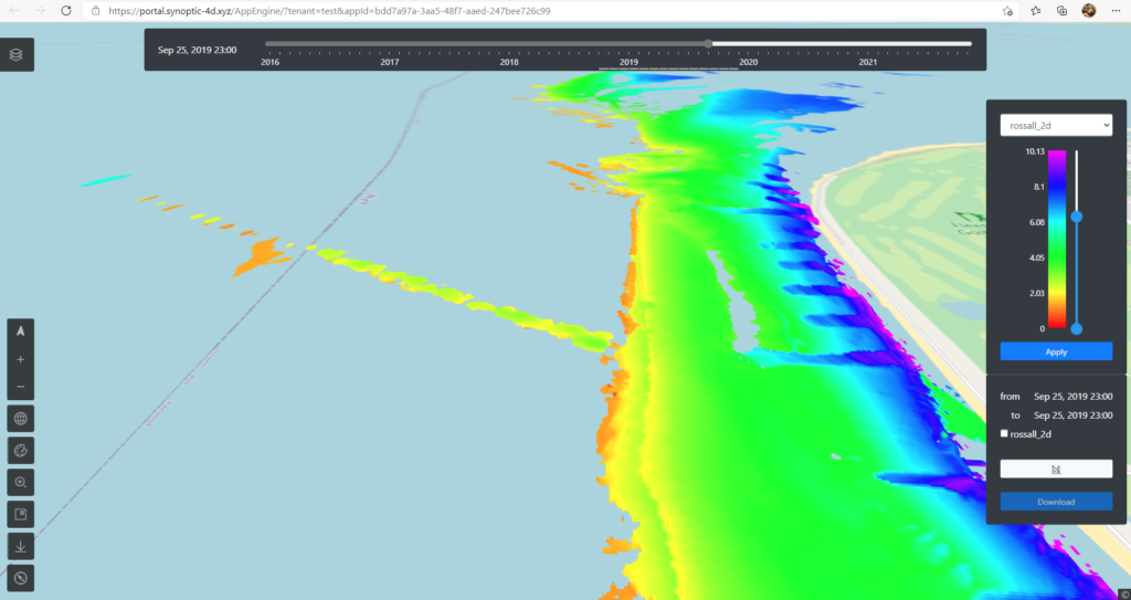
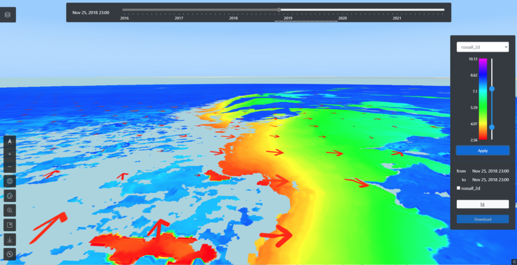
Today we’re pleased to announce beta trials of our new Synoptic 4D data exploration portal with some of our users. Below are some sneak peeks of it with data from the Rossall coastal defence scheme for which we have been collecting data for 2 years.

Benefits and features of Synoptic-4D portal: 

- Web-based platform hosts your data so you don’t have to. Easily accessed from any web browser, not only from your office
- Configurable layers of data over a global basemap to understand cause and effect together
- Timeslider provides navigation through time of all layers simultaneously, enabling the examination and visualisation of time-variant phenomena
- Focus mode allows you to concentrate on a on a smaller part of your view
- 2D and 3D modes allow the maps to be viewed in plan and perspective views enabling a greater connection to the physical environment
- Find and identify features in the terrain data with easy slide & click palette customisation
- Downloading data for analysis in external/existing tools is as easy as drawing a box and selecting the layers and times of interest


